Rancho San Antonio Preserve hiking guide
Rancho San Antonio is the most popular open space in this part of the valley. You get easy walks to a working farm, shady canyon loops and a long climb to Black Mountain, all starting at the end of Cristo Rey Drive.
How it works
The area is really two parks joined together. The Rancho San Antonio County Park (about 289 acres) holds the parking lots, lawns and restrooms. The much larger Rancho San Antonio Open Space Preserve (nearly 4,000 acres) holds the trails into the hills. The Midpeninsula Regional Open Space District, usually called Midpen, runs both.
Parking: the thing that decides your day
There are about 335 parking spaces across six numbered lots and a small area at Rhus Ridge Road. That sounds like a lot until you see a sunny Saturday. By mid-morning on weekends the lots are often full and cars circle waiting for spaces.
What helps:
- Go early or go on a weekday. The preserve opens half an hour before sunrise.
- Check Midpen's live parking page before you leave home, or look at the electronic sign at the gate.
- Follow the posted parking signs on Cristo Rey Drive and in the nearby neighborhoods. When the lots are full, it's better to come back another time than to park where you shouldn't.
- Try the shared shuttle. Midpen points visitors to Silicon Valley Hopper, an on-demand shared ride service that serves the preserve from Cupertino and from the Mountain View, Sunnyvale and Santa Clara Caltrain stations.
Directions: From Interstate 280, take the Foothill Boulevard exit and go south about 0.2 miles to Cristo Rey Drive. Turn right and continue about a mile. Go right around the traffic circle, then turn left into the county park entrance.
Trails, from easy to hard
| Walk | Distance | What it is like |
|---|---|---|
| Deer Hollow Farm | About 2 miles round trip | Wide and mostly flat. Good for kids and strollers. |
| Wildcat Loop | About 3 miles | Follows a shaded, fern-lined canyon and returns to the farm. |
| Chamise Trail | 2.1 miles one way | Climbs to a meadow in the north part of the preserve. |
| Stephen E. Abbors Trail | 3.7 miles one way | About 1,600 feet of climbing. Hard work and good views. |
| Black Mountain | About 4 miles one way | A long climb to the 2,800-foot summit. For fit hikers with a full day. |
Distances are from Midpen's preserve page. Some routes link up, so check the Midpen trail map for the exact loop you want. Shade is patchy on the upper trails. Bring more water than you think you need from May to October.
Deer Hollow Farm
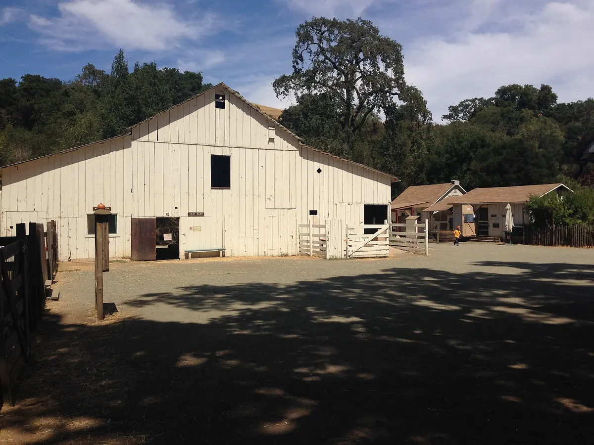
The farm is about a mile in from the main lot. It's a working homestead on what was the Grant Ranch in the late 1800s, with sheep, goats, chickens and a garden. The City of Mountain View runs it, with help from Cupertino and other nearby cities. The animal pens and buildings aren't open to the public, but you can see the animals from the fences along the trail. The farm is closed on Mondays. Picnic tables are at the north end of the farm. The Friends of Deer Hollow Farm group sometimes sells eggs and seasonal produce.
Bikes and horses
Bikes are allowed on designated trails only and not west of Deer Hollow Farm. Helmets are required. The speed limit is 15 mph, or 5 mph when passing. Class 1 and 2 e-bikes may use some improved trails. Horses use the equestrian parking area. Some trails close to horses in wet weather.
Nearby
- Picchetti Ranch and winery, 15 minutes south on Foothill Boulevard
- Fremont Older, if you want to bring the dog next time
- Apple Park Visitor Center, 15 minutes east on Interstate 280
Plan your trip
Common questions
How long is the walk to Deer Hollow Farm?
About 1 mile each way from the main parking area, on a wide, mostly flat path. Plan on an hour there and back with time to look at the animals.
Can I bring my dog to Rancho San Antonio?
No. Dogs are not allowed in this preserve. Fremont Older, about 15 minutes away, allows dogs on leash.
Is Rancho San Antonio in Cupertino or Los Altos?
Both, in a sense. The entrance on Cristo Rey Drive has a Cupertino address, and the preserve stretches into the hills behind Los Altos and Los Altos Hills.
How do I know if the parking lots are full?
Midpen posts real-time parking availability on its Rancho San Antonio parking page, and there is an electronic sign at the entrance gate.
How we checked this page
We last checked the facts on this page on November 21, 2026 against the sources below. Hours, prices and rules change, so confirm anything important with the source before you go. Spot an error? Tell us and we will fix it.